1938 July 29th Cocker destroys Waterloo (Barrel) bridge 3ft in Main Street
Very heavy rainfall occurred in the upper part of the catchment with a daily total of 6 to 7 inches as Borrowdale, 4 to 5 inches at Newlands and Braithwaite. As a summer flood, the inundation of agricultural land had a much more damaging effect than the more common winter floods. Derwentwater and Bassenthwaite were joined together but Keswick itself was free of floods. Thirlmere was so low that it was capable of taking all the flood water and did not overflow. Footbridges at Scafell Hotel and at Styhead were washed away and at Mountain View the water almost reached the houses. Traffic to Cockermouth was diverted to the Castle Inn side of Bassenthwaite to avoid deep flooding at Braithwaite and Portinscale.
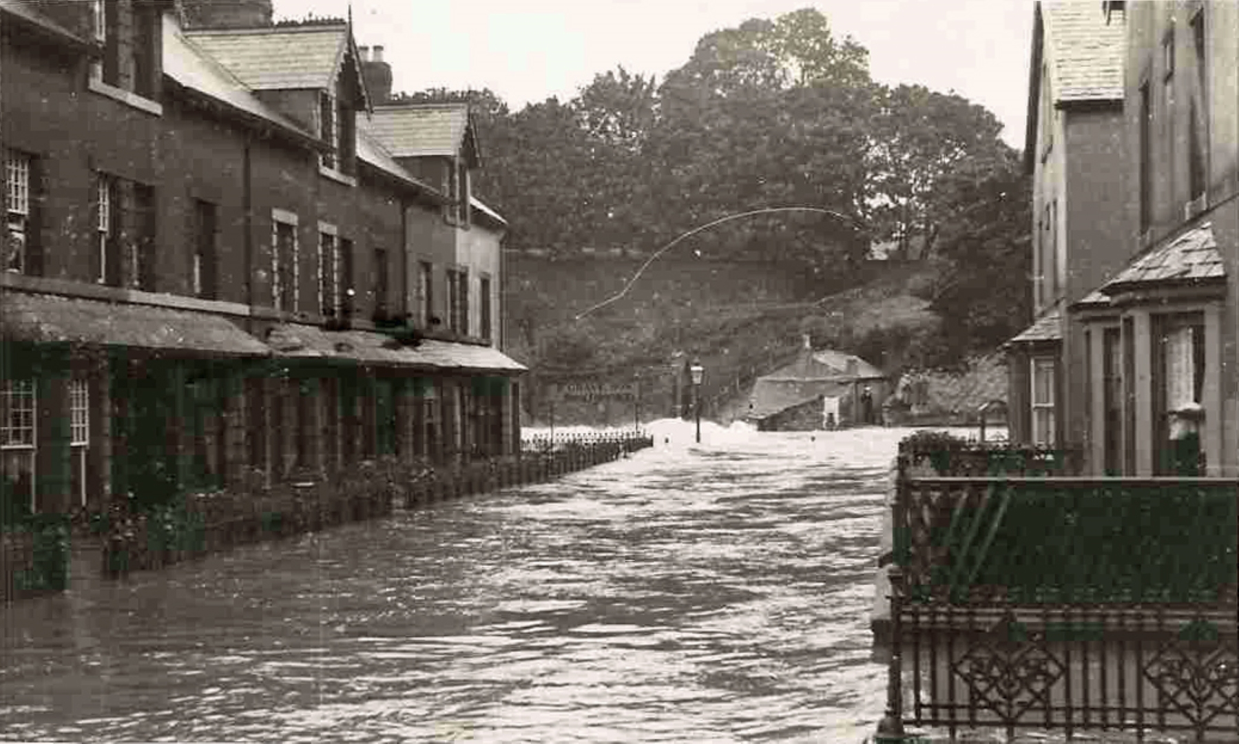
In Cockermouth on this occasion the River Cocker alone was responsible for the flooding of the Main Street, although the Derwent later overflowed into the lower part of the town. The Main Street was flooded to a depth of 3 feet and Carlisle Journal reported it to be the worst flood there since 1918. The Cocker rose very rapidly. When shops were first opened there was no sign of a flood but early customers had to leave by the back to avoid the rising water.
The water rose over the Quaker Bridge connecting Lower South Street and Cocker Lane; it was pounded by tree trunks and it cracked in the centre and most of the steel railings and stone masonry were swept away.
The Waterloo Bridge aka Barrel Bridge between High Sand Lane/Waterloo Street and Brewery Lane on 29th July 1938 collapsed at 1330hrs and was not replaced until after WW2 had ended. That bridge was named because barrels were rolled over it from the manufacturing sites in Waterloo Street to the brewery, but the bridge was wide enough for motor traffic and had a central support and had paving stones for the wheels. Cumberland Motor Services buses and brewery wagons used the bridge until its collapse in 1938.
A large part of the town suffered losses and many houses and shops were damaged. Challoner Street was converted into a roaring torrent, three feet deep. On a lane off Market Street water was lapping the tops of ground floor doors. Horseman Street suffered from the backing up of drains. The proprietor of Huddart’s shop on the Keswick side of the Cocker Bridge had to leave for safety; he said that in 1918 the flood did not reach the top stair of the cellar whilst on this occasion it was 2 feet over it. The shop was later demolished and the business moved next door and is still there. A South Street resident of 50 years who had 4 feet of water in her living room said it was the highest experienced, the previous highest being in Oct 1918. A 15 lb pike was caught in the Main Street.
Observed from Derwent Mill Bridge the Cocker was riding 6 feet higher than the Derwent, pounding against the remains of Barrel Bridge. During the night the Derwent rose to flood properties, but in the meantime the Cocker had subsided. It was said that additional square arches added to the Goat Bridge kept most of the Goat free of floodwater and only houses at the lower end were affected.
After the flood hundreds of tons of gravel were found deposited near the junction of the Derwent and Cocker 100 yards below the wrecked Barrel Bridge. The Carlisle Journal published a page of flood photographs eg: Challoner Street transformed into a roaring torrent; Policeman assisting stranded shoppers; River Cocker overtopping the Barrel Bridge; Pedestrians viewing the flood from the corner of Station Street and Main Street; The broken Jubilee footbridge at the foot of Cocker Brow; The extreme turbulence of the Cocker flowing into the Derwent below Barrel Bridge; South Street leading to Challoner Street; Surging and turbulent flow over the remains of Barrel Bridge.
Workington escaped with little damage, although at the Workington Bridge Station, trains had to travel through water three feet deep which partly covered the platforms. The Grasslot area of Maryport was again flooded and even more seriously than in 1932.
The Rotarians of Cockermouth opened a Flood Relief Fund and many houses were supplied with coal.
Photos of Waterloo bridge over Cocker in flood 1938
Waterloo bridge over Cocker in flood 1938 It was a road bridge until 1938 and had a central support and brewery lorries and Cumberland Motor Service buses drove over it to the brewery buildings and garage opposite the multi storey malting building. After half of the bridge was washed away in this flood. A photos taken after the flood shows a tree trunk precariously balanced on the gap between Waterloo Street and the remaining central support, though this likely was to support a utility cable or pipe and not for walking on! In 1963 a footbridge replaced the destroyed road bridge, though the day of the official opening had to be delayed because another flood dislodged the new bridge and it had to be raised higher and was eventually opened by the Head Boy of Cockermouth Grammar School.
Record of Floods in Cockermouth – Cockermouth History