Market Street behind the Town Hall ex Methodist church was the Hatters Arms, sometimes known as the Hatters beer house. It may have gained its name because its patrons came from Cockermouth's largest hat factory by Cocker bridge. The overgrown area was the drying ground for Sandersons Mill now car park. c 1960
Market Street Menu
Market Street leads to the Town Hall seen here with the archway (that still exists) leading to the drying ground of Sandersons Mill. The houses on Kirkbank were built in the early 1930s and the new Methodist Church on Lorton Street was opened in 1932 and Cockermouth UDC took over the building. Below the rear wall of the Methodist / Town Hall is the gable end of buidings that led to the Hatters pub. The buildings beyond the archway became Town Hall car park in the 1970s. The person with red shorts looks at the Bitter Beck joining the Cocker. The building on the left is disused Thomas Wilson’s hat factory that was demolished in 1970s. Note bottom left the arch for Bitter Beck which now has a flat girder supporting the outdoor patio of the rebuilt end of the building on left edge. c 1970
Market Street behind the Town Hall ex Methodist church was the Hatters Arms, sometimes known as the Hatters beer house. It may have gained its name because its patrons came from Cockermouth’s largest hat factory by Cocker bridge. The overgrown area was the drying ground for Sandersons Mill now car park. c 1960
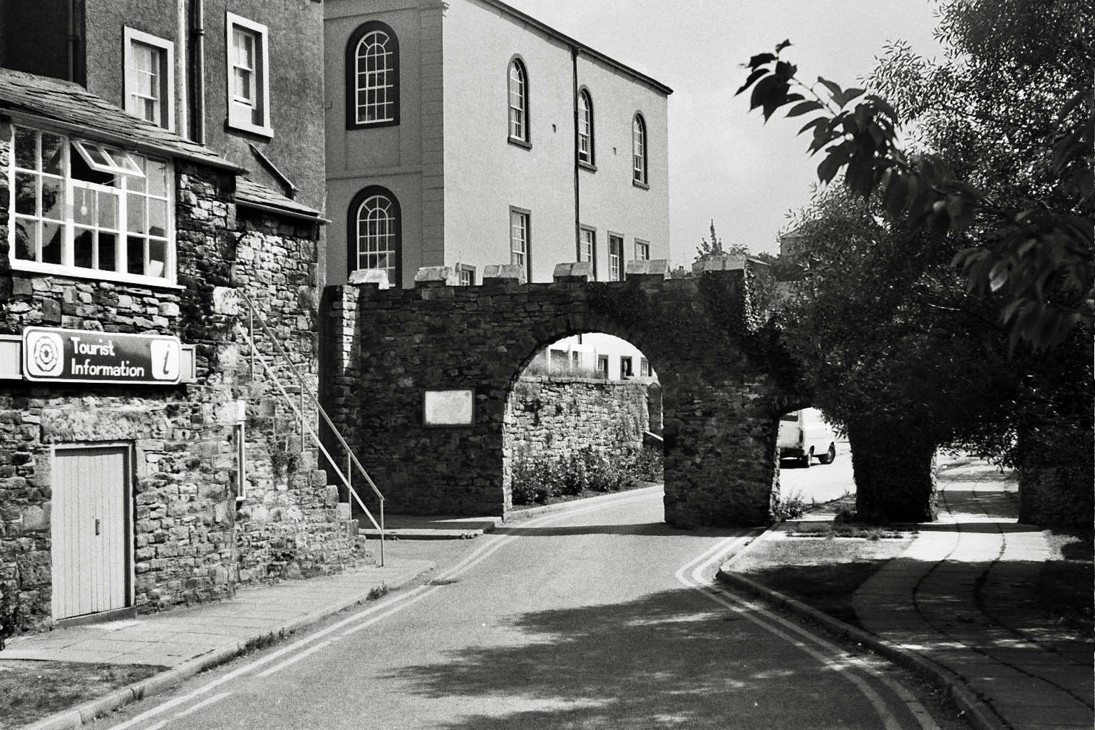
Town Hall former armoury for the Border Regiment on the left. They later moved to the Drill Hall and this building became the tourist information then gifts and is now unused. The archway to the car park below the Town Hall can be seen. The river Cocker is on the right. c 1960
Before demolition of the houses on the right and the lean to on the left to make way for the road that goes under the archway into the car park below the Town Hall with the Cocker on the right. The row of houses top left is top of Market Street and lead to the Town Hall. The two storey building was The Armory used by the Cumberland and Westmorland Yeomanry before they moved to the Drill Hall St Helens Street which is now part of the Sports Centre. 1986
Town Hall former armoury for the Border Regiment on the left. They later moved to the Drill Hall and this building became the tourist information then gifts and is now unused. The archway to the car park below the Town Hall can be seen. The river Cocker is on the right. c 1960
Market Street Town Hall the single storey building is the tourist information centre before moving into the Town Hall c 1980
Market Street leads to the Town Hall seen here with the archway (that still exists) leading to the drying ground of Sandersons Mill. The houses on Kirkbank were built in the early 1930s and the new Methodist Church on Lorton Street was opened in 1932 and Cockermouth UDC took over the building. Below the rear wall of the Methodist / Town Hall is the gable end of buildings that led to the Hatters pub. The buildings beyond the archway became Town Hall car park in the 1970s. The person with red shorts looks at the Bitter Beck joining the Cocker. The building on the left is disused Thomas Wilson’s hat factory that was demolished in 1970s.
Market Street proposed car park below the Town Hall. This view shows Quaker foot bridge over the Cocker and Jubilee bridge below the higher railway bridge. 1968
Market Street proposed car park overgrown land that was developed into the car park below the Town Hall, Quaker bridge ahead. On the right is Croft Mill, later developed into flats. photo 1968
Market Street proposed car park in this area with the Old Hall dominating the photo with many congested housing surrounding it. All were demolished in 1974 for the Town Hall car park, photo from 1968
Market Street Methodist church became Town Hall with hat factory on left Cocker raft race 1980
The old Market Hall is on the right, now demolished and a new row of houses built. Ahead is the lane leading to the rear of Kirkgate. On the left are various houses built around the Old Hall which is further to the left, this was a very congested area with lots of houses crammed together “Like a rabbit warren” a local person described. The houses to the left were demolished in 1974 and the Town Hall car park built. photo from 1968
Market Street entrance to town hall car park through the archway steps to the former tuition formation which is now closed. c 1970
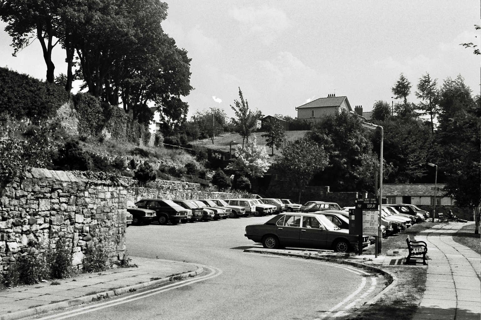
Market Street car park behind Cockermouth Town Hall c 1980
Town Hall Tourist Information building with the archways in the wall that were damaged in the 2009 flood so taken down and rebuilt.c 1980